EME Reporting Process
As the lead carrier is responsible for running any required Deployment Code processes and notifications, the lead carriers RF team will be responsible for creating and uploading the EME report and RFmap2 configuration file. Prior to any EME report being generated, the lead carrier’s RF engineer should check that the other carrier has entered their STAD table information. If the other carrier’s STAD information is not available, email the PM for the site to request that the information is added as soon as possible. There are three types of Points of Interest (POI) community, topographic and near field. In general there should be atleast one Community POI. This may be a school, childcare or aged care facility hospital etc. In addition the closest residence may be used provided it is not too close say < 30m from the site1-Due to the addition of many new technologies at various frequencies, the proposed EME levels may increase significantly above what they were previously. Due to RFMap2 using a flat earth model and the increased power levels, it is important that a near field analysis is done on all sites particularly where there is a change in ground level near the site or where there are tall buildings nearby and where the
EME levels may be higher than expected.
As a general rule buildings that are taller than half the height of the antenna and within 100 metres of the site, should be considered as Topographic POI’s and have a vertical scan done to check for levels >10% of the ARPANSA standard. If the “Proposed” EME levels are greater than 10% of the ARPANSA standard either on the ground or at any POI, the site must be escalated to the state EME prime at the SAED Phase –prior to any community consultation activities being undertaken. They will undertake an internal review of the calculations, assumptions and methodologies to confirm the prediction is correct before proceeding. This will include verifying the data on the RFNSA in relation to all existing installations at the site including other carrier STAD’s. Once the State EME prime confirms that the calculations are correct they should notify the relevant PM before proceeding with uploading the EME report to the RFNSA this is to ensure that it is not a community sensitive site and that no other action is required.
If the EME level is less that 10% of the ARPANSA standard, the EME report can be converted to PDF format and uploaded to the NSA along with the RFMap2 configuration file in the normal manner. If the “Proposed” EME levels are estimated to be greater than 25% of the ARPANSA standard either on the ground or any point of public access including roof tops or balconies the Carrier will organise an independent review of the predictions by a NATA accredited RF Assessor in the form of a PRD (Preliminary RF Drawing) before proceeding.
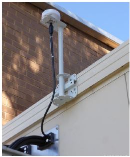
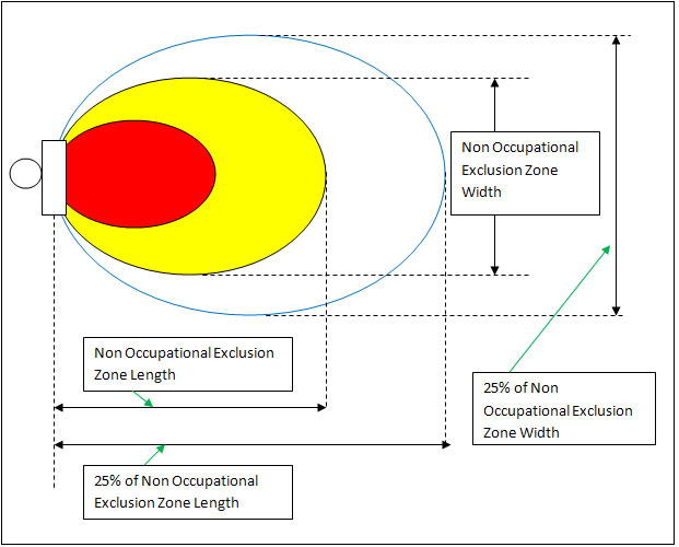
The AMTA document “Base Station Design Guidelines: Engineering for Access” located in the RFSCP Manual 2 v2 Chapter 2 P21 provides guidelines to design engineers to ensure that radiating antenna are designed and installed is such a way as to provide adequate separation between publicly accessible areas and EME exclusion zones.
Once the NATA accredited RF Assessor’s review is complete and accepted, the State EME prime shall notify the relevant PM before proceeding with uploading the EME report to the RFNSA to ensure that it is not a community sensitive site and that no further action is required. Once the RF engineer is happy that the EME report is accurate, it should be uploaded to the RFNSA along with the RFMap2 configuration file. For new green field sites, it is important to check that the NSA entry is not in “Draft Mode” prior to uploading the EME report as per the screen capture below.